I currently develop an application that creates polygons from lines and I experience a small problem:
I have a set of points, representing a line. I would like to create a polygon that displays the line with a specific width (e.g. for a street). I have several ideas how to calculate the outer polygon points, but I think they are too complicated...
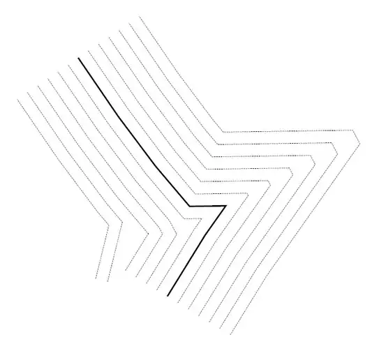
My best idea was the one pictured below: Every point of the line must be projected to at least two points: Both points must be 90° to the following line segment and have a distance half of the preferred polygon width.

This works good, as you can see at the end and start points of the pictured polygon. Now the complicated part: With this method, at a corner, each point gets four points. But these points are not correct for the outer polygon, because they are in the shape. The lines intersected and created an ugly polygon.
How can I find the correct points for such a polygon? I think my method is far too complicated for solving this problem.
Can anybody help me with this (propably very common) problem?
Info: I tagged this with openstreetmap because renderer like Mapnik have this problem, too.