Fougerolles-Saint-Valbert | |
|---|---|
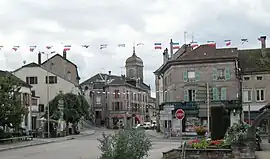 Fougerolles | |
Location of Fougerolles-Saint-Valbert | |
 Fougerolles-Saint-Valbert 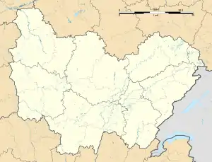 Fougerolles-Saint-Valbert | |
| Coordinates: 47°53′10″N 6°24′12″E / 47.8861°N 6.4033°E | |
| Country | France |
| Region | Bourgogne-Franche-Comté |
| Department | Haute-Saône |
| Arrondissement | Lure |
| Canton | Saint-Loup-sur-Semouse and Luxeuil-les-Bains |
| Intercommunality | Haute Comté |
| Government | |
| • Mayor (2020–2026) | Benoît Miège[1] |
| Area 1 | 55.02 km2 (21.24 sq mi) |
| Population | 3,780 |
| • Density | 69/km2 (180/sq mi) |
| Time zone | UTC+01:00 (CET) |
| • Summer (DST) | UTC+02:00 (CEST) |
| INSEE/Postal code | 70245 /70220 |
| Elevation | 276–569 m (906–1,867 ft) |
| 1 French Land Register data, which excludes lakes, ponds, glaciers > 1 km2 (0.386 sq mi or 247 acres) and river estuaries. | |
Fougerolles-Saint-Valbert (French pronunciation: [fuʒʁɔl sɛ̃ valbɛʁ]) is a commune in the Haute-Saône department in the region of Bourgogne-Franche-Comté in eastern France. It was established on 1 January 2019 by merger of the former communes of Fougerolles (the seat) and Saint-Valbert.[3]
Population
| Year | Pop. | ±% p.a. |
|---|---|---|
| 1968 | 4,435 | — |
| 1975 | 4,218 | −0.71% |
| 1982 | 4,341 | +0.41% |
| 1990 | 4,377 | +0.10% |
| 1999 | 4,162 | −0.56% |
| 2007 | 4,068 | −0.29% |
| 2012 | 3,963 | −0.52% |
| 2017 | 3,803 | −0.82% |
| Source: INSEE[4] | ||
See also
References
- ↑ "Répertoire national des élus: les maires" (in French). data.gouv.fr, Plateforme ouverte des données publiques françaises. 13 September 2022.
- ↑ "Populations légales 2021". The National Institute of Statistics and Economic Studies. 28 December 2023.
- ↑ Arrêté préfectoral 25 September 2018 (in French)
- ↑ Population en historique depuis 1968, INSEE
Wikimedia Commons has media related to Fougerolles-Saint-Valbert.
This article is issued from Wikipedia. The text is licensed under Creative Commons - Attribution - Sharealike. Additional terms may apply for the media files.