Lamotte-Warfusée | |
|---|---|
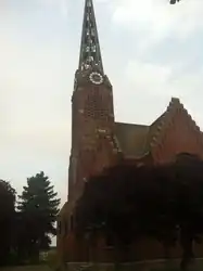 The church in Lamotte-Warfusée | |
Location of Lamotte-Warfusée | |
 Lamotte-Warfusée 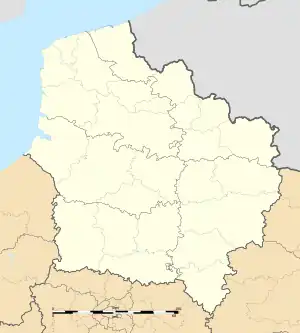 Lamotte-Warfusée | |
| Coordinates: 49°52′20″N 2°35′46″E / 49.8722°N 2.5961°E | |
| Country | France |
| Region | Hauts-de-France |
| Department | Somme |
| Arrondissement | Amiens |
| Canton | Corbie |
| Intercommunality | Val de Somme |
| Government | |
| • Mayor (2020–2026) | Frédéric Dehurtevent[1] |
| Area 1 | 9.36 km2 (3.61 sq mi) |
| Population | 705 |
| • Density | 75/km2 (200/sq mi) |
| Time zone | UTC+01:00 (CET) |
| • Summer (DST) | UTC+02:00 (CEST) |
| INSEE/Postal code | 80463 /80800 |
| Elevation | 35–101 m (115–331 ft) (avg. 77 m or 253 ft) |
| 1 French Land Register data, which excludes lakes, ponds, glaciers > 1 km2 (0.386 sq mi or 247 acres) and river estuaries. | |
Lamotte-Warfusée is a commune in the Somme department in Hauts-de-France in northern France.
Geography
The commune is situated on the N29 road, some 16 miles (26 km) east of Amiens. Lamotte-Warfusée was created as a commune in 1974, by the joining of the ancient communes of Lamotte-en-Santerre and Warfusée-Abancourt.
Population
| Year | Pop. | ±% p.a. |
|---|---|---|
| 1968 | 447 | — |
| 1975 | 436 | −0.36% |
| 1982 | 447 | +0.36% |
| 1990 | 481 | +0.92% |
| 1999 | 513 | +0.72% |
| 2007 | 565 | +1.21% |
| 2012 | 674 | +3.59% |
| 2017 | 703 | +0.85% |
| Source: INSEE[3] | ||
See also
References
- ↑ "Répertoire national des élus: les maires". data.gouv.fr, Plateforme ouverte des données publiques françaises (in French). 2 December 2020.
- ↑ "Populations légales 2021". The National Institute of Statistics and Economic Studies. 28 December 2023.
- ↑ Population en historique depuis 1968, INSEE
Wikimedia Commons has media related to Lamotte-Warfusée.
This article is issued from Wikipedia. The text is licensed under Creative Commons - Attribution - Sharealike. Additional terms may apply for the media files.