Lužec nad Vltavou | |
|---|---|
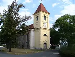 Church of Saint Giles | |
 Flag  Coat of arms | |
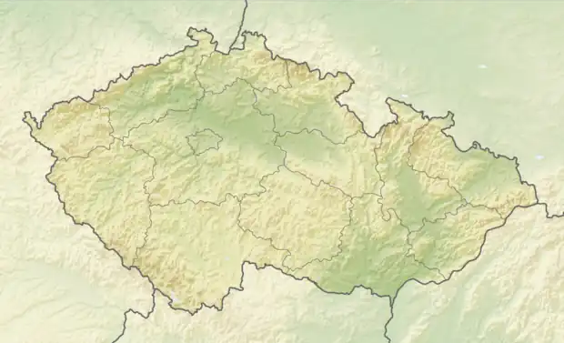 Lužec nad Vltavou Location in the Czech Republic | |
| Coordinates: 50°19′17″N 14°24′1″E / 50.32139°N 14.40028°E | |
| Country | |
| Region | Central Bohemian |
| District | Mělník |
| First mentioned | 1223 |
| Area | |
| • Total | 10.00 km2 (3.86 sq mi) |
| Elevation | 164 m (538 ft) |
| Population (2023-01-01)[1] | |
| • Total | 1,488 |
| • Density | 150/km2 (390/sq mi) |
| Time zone | UTC+1 (CET) |
| • Summer (DST) | UTC+2 (CEST) |
| Postal code | 277 06 |
| Website | www |
Lužec nad Vltavou is a municipality and village in Mělník District in the Central Bohemian Region of the Czech Republic. It has about 1,500 inhabitants.
Administrative parts
The village of Chramostek is an administrative part of Lužec nad Vltavou.
Geography
Lužec nad Vltavou is located about 6 km (4 mi) west of Mělník and 22 km (14 mi) north of Prague. It lies in a flat agricultural landscape in the Central Elbe Table. The municipality is situated on the left bank of the Vltava River.
History
The first written mention of Lužec nad Vltavou is from 1223.[2]
Sights
The landmark of Lužec nad Vltavou is the Church of Saint Giles. It was built in the Baroque style in 1762.[3]
Notable people
- Miloš Jiránek (1875–1911), painter, art critic and writer
References
- ↑ "Population of Municipalities – 1 January 2023". Czech Statistical Office. 2023-05-23.
- ↑ "Lužec nad Vltavou (Česko)" (in Czech). Středočeská vědecká knihovna v Kladně. Retrieved 2023-04-01.
- ↑ "Kostel sv. Jiljí" (in Czech). National Heritage Institute. Retrieved 2023-04-01.
External links
Wikimedia Commons has media related to Lužec nad Vltavou.
This article is issued from Wikipedia. The text is licensed under Creative Commons - Attribution - Sharealike. Additional terms may apply for the media files.