Zálezlice | |
|---|---|
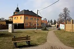 Centre of Zálezlice | |
 Flag  Coat of arms | |
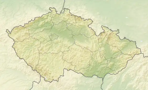 Zálezlice Location in the Czech Republic | |
| Coordinates: 50°18′28″N 14°26′15″E / 50.30778°N 14.43750°E | |
| Country | |
| Region | Central Bohemian |
| District | Mělník |
| First mentioned | 1300 |
| Area | |
| • Total | 7.60 km2 (2.93 sq mi) |
| Elevation | 163 m (535 ft) |
| Population (2023-01-01)[1] | |
| • Total | 436 |
| • Density | 57/km2 (150/sq mi) |
| Time zone | UTC+1 (CET) |
| • Summer (DST) | UTC+2 (CEST) |
| Postal code | 277 45 |
| Website | www |
Zálezlice is a municipality and village in Mělník District in the Central Bohemian Region of the Czech Republic. It has about 400 inhabitants.
Administrative parts
Villages of Kozárovice and Zátvor are administrative parts of Zálezlice.
Geography
Zálezlice is located about 6 km (4 mi) southwest of Mělník and 22 km (14 mi) north of Prague. It lies in a flat landscape in the Central Elbe Table. The municipality is situated on the right bank of the Vltava River.
History
The first written mention of Zálezlice is from the beginning of the 13th century.[2]
The municipality was badly damaged during the 2002 European floods and has been protected by a flood wall since then.[3]
Sights
The landmark of Zálezlice is the Church of Saint Nicholas. It is a late Baroque building from the second half of the 18th century. The church includes a Baroque mortuary.[4]
Notable people
- Vítězslav Hálek (1835–1874), poet, writer and journalist; lived here in 1841–1842
Gallery
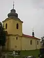 Church of Saint Nicholas
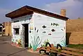 Decoration of the bus shelter commemorating the 2002 floods
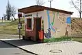 Bus shelter in Kozárovice
References
- ↑ "Population of Municipalities – 1 January 2023". Czech Statistical Office. 2023-05-23.
- ↑ "Historie obce" (in Czech). Obec Zálezlice. Retrieved 2023-02-06.
- ↑ "Povodně 2002 v Zálezlicích: Vypadalo to děsivě, jako po válce, vzpomíná starosta" (in Czech). Deník.cz. 2022-08-13. Retrieved 2023-02-06.
- ↑ "Kostel sv. Mikuláše" (in Czech). National Heritage Institute. Retrieved 2023-02-06.