Rahi
Rāhi | |
|---|---|
Village | |
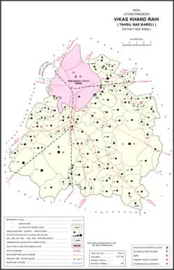 Map of Rahi CD block | |
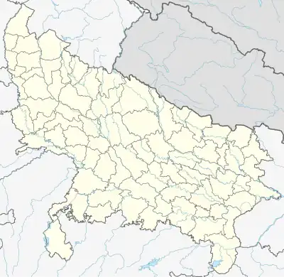 Rahi Location in Uttar Pradesh, India | |
| Coordinates: 26°14′20″N 81°18′11″E / 26.238867°N 81.30313°E[1] | |
| Country India | |
| State | Uttar Pradesh |
| District | Raebareli |
| Area | |
| • Total | 6.89 km2 (2.66 sq mi) |
| Population (2011)[2] | |
| • Total | 7,536 |
| • Density | 1,100/km2 (2,800/sq mi) |
| Languages | |
| • Official | Hindi |
| Time zone | UTC+5:30 (IST) |
| Vehicle registration | UP-35 |
Rahi is a village and corresponding community development block in Rae Bareli district, Uttar Pradesh, India.[2] It is located 7 km from Rae Bareli, the district headquarters,[3] which according to one folk etymology is named after the village.[4] Rahi was formerly the seat of a pargana before Rae Bareli replaced it in that capacity.[4] As of 2011, Rahi has a population of 7,536 people, in 1,373 households.[2] It has one primary school and one medical clinic.[2]
The 1961 census recorded Rahi as comprising 10 hamlets, with a total population of 2,950 people (1,664 male and 1,286 female), in 617 households and 576 physical houses.[5] The area of the village was given as 1,708 acres and it had a post office at that point.[5] It had one grain mill and 3 makers of jewellery and/or precious metal items.[5]
The 1981 census recorded Rahi as having a population of 4,611 people, in 951 households, and having an area of 363.30 hectares.[3] The main staple foods were given as wheat and rice.[3]
Villages
Rahi CD block has the following 106 villages:[2]
| Village name | Total land area (hectares) | Population (in 2011) |
|---|---|---|
| Umara | 251.5 | 1,916 |
| Kasehti | 232.5 | 1,400 |
| Sikandarpur | 94.8 | 608 |
| Rahi (block headquarters) | 689 | 7,536 |
| Prem Rajpur | 121.3 | 1,374 |
| Chak Pachkhara | 66.1 | 628 |
| Kasimpur Baghail | 105.6 | 410 |
| Rampur Baghail | 88.6 | 670 |
| Dohri | 100.8 | 731 |
| Pure Siddha | 91.7 | 528 |
| Govindpur | 123.5 | 864 |
| Radhanpur | 72.2 | 1,124 |
| Painte Mau | 63.7 | 617 |
| Kalanderpur | 73.4 | 712 |
| Rustampur | 323.6 | 4,546 |
| Manpur Saharwa | 43.6 | 394 |
| Bani | 86.2 | 672 |
| Chak Lodipur | 69.2 | 449 |
| Tamberpur | 63.2 | 407 |
| Alauddeenpur | 39.5 | 274 |
| Bakwara | 196.7 | 1,540 |
| Ratansipur | 393.7 | 3,122 |
| Barwaripur | 71.3 | 154 |
| Salempur Siki | 196 | 1,647 |
| Bhatpurwa | 79.2 | 787 |
| Bandra Mau | 271.8 | 3,101 |
| Jagdishpur | 217 | 1,727 |
| Chak Bhadurpur | 156.5 | 0 |
| Chak Shahabuddeenpur | 23.9 | 879 |
| Akbarpur Kachhwah | 219.3 | 4,261 |
| Chak Baholiyapur | 21.1 | 14 |
| Ibrahimpur | 219.3 | 952 |
| Kolwa Khurd | 73.3 | 923 |
| Bibipur Mutfarrikat | 89 | 949 |
| Godwa Gadiyani | 64.2 | 0 |
| Mahanandpur | 28.7 | 0 |
| Behta Khurd | 478.2 | 2,654 |
| Bhoye Mau | 221.7 | 1,318 |
| Sulakhiyapur | 321.5 | 2,423 |
| Madhupuri | 215.1 | 2,445 |
| Garhi Mutwalli | 197.7 | 1,634 |
| Jahanpur Kodar | 215.6 | 1,525 |
| Jhakrasi | 481.8 | 3,828 |
| Dariyapur | 122.4 | 1,940 |
| Sultanpur Aaima | 58.6 | 448 |
| Pasapur | 56.3 | 550 |
| Khnuwa | 134.8 | 863 |
| Vinohra | 305.3 | 2,256 |
| Fakharul Hasan Khera | 116.6 | 731 |
| Machhechhar | 70.3 | 519 |
| Saidanpur | 277.9 | 1,854 |
| Khagipur Sadwa | 223.4 | 2,020 |
| Suraj Kunda | 273.6 | 2,196 |
| Rajapur | 214.4 | 1,245 |
| Zafarapur | 121 | 1,474 |
| Bela Khara | 887.5 | 5,928 |
| Bela Gusisi | 1,068.5 | 7,320 |
| Bela Bhela | 2,118.9 | 16,623 |
| Mohammadpur Kuchariya | 383 | 3,249 |
| Paliya | 94.4 | 765 |
| Udrehari | 93.6 | 1,045 |
| Bela Tekai | 661 | 4,634 |
| Sarai Damu | 470.9 | 3,948 |
| Chak Nizam | 184.9 | 806 |
| Bhaon | 385 | 4,161 |
| Chak Vallihar | 96 | 566 |
| Ikauna | 110 | 1,101 |
| Jamalpur Nankari | 156.9 | 1,203 |
| Chak Mansahari | 21 | 205 |
| Sarai Muhammad Sharif | 175.5 | 1,313 |
| Ekchhaniya | 57.6 | 535 |
| Kachaunda Muhiuddinpur | 572.5 | 4,034 |
| Paraura | 174.8 | 1,060 |
| Raghunathpur | 157.2 | 1,217 |
| Bhaironpur Kataili | 85.7 | 373 |
| Eksana | 187.6 | 847 |
| Korchanda Mau | 129 | 1,022 |
| Bhakhwara | 161.2 | 876 |
| Bhadokhar | 533.6 | 3,312 |
| Purushottampur Karor | 47.1 | 415 |
| Raipur Maheri | 224.3 | 1,753 |
| Chak Bhadokhar | 33.5 | 115 |
| Kola Haibatpur | 178.4 | 1,826 |
| Mulihamau | 354.2 | 2,094 |
| Jaraulla | 245 | 1,311 |
| Ayaspur Dihi | 114.4 | 1,635 |
| Godwara | 506.9 | 3,824 |
| Monai | 108.2 | 1,014 |
| Nathuwapur | 106.5 | 907 |
| Chak Rar | 148.4 | 1,005 |
| Mohgawan | 266.5 | 1,892 |
| Lodhwari | 1,517.6 | 10,592 |
| Anti Naugawan | 524.2 | 2,668 |
| Khurhati | 668.4 | 4,727 |
| Chak Kirihra | 103.9 | 686 |
| Kamauli | 340 | 3,147 |
| Anuruddhapur | 91.9 | 1,528 |
| Tala Gopalpur | 344.5 | 1,902 |
| Basarh | 408.8 | 2,732 |
| Semra | 194.3 | 1,408 |
| Prmanpur | 169 | 1,365 |
| Jariyari | 191.2 | 1,688 |
| Sanhi | 503.4 | 3,645 |
| Bhaidpur | 187 | 1,473 |
| Balepur | 149 | 1,266 |
References
- ↑ "GeoNames Search". geonames.nga.mil. Archived from the original on 12 April 2014. Retrieved 12 August 2023.
- 1 2 3 4 5 6 "Census of India 2011: Uttar Pradesh District Census Handbook - Rae Bareli, Part A (Village and Town Directory)" (PDF). Census 2011 India. pp. 219–43. Retrieved 9 August 2021.
- 1 2 3 Census 1981 Uttar Pradesh: District Census Handbook Part XIII-A: Village & Town Directory, District Rae Bareli (PDF). 1982. pp. 90–1. Retrieved 9 August 2021.
- 1 2 Nevill, H.R. (1905). Rai Bareli: A Gazetteer, Being Volume XXXIX Of The District Gazetteers Of The United Provinces Of Agra And Oudh. Allahabad: Government Press. p. 205. Retrieved 9 August 2021.
- 1 2 3 Census 1961: District Census Handbook, Uttar Pradesh (39 - Raebareli District) (PDF). Lucknow. 1965. pp. 166–7, xliv-xlv of section "Rae Bareli Tahsil", cxxiii, cxxv–cxxvi. Retrieved 9 August 2021.
{{cite book}}: CS1 maint: location missing publisher (link)