Saint-Hilaire | |
|---|---|
Commune | |
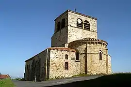 Church of Saint-Hilaire | |
.svg.png.webp) Coat of arms | |
Location of Saint-Hilaire | |
 Saint-Hilaire 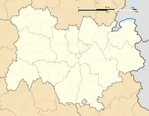 Saint-Hilaire | |
| Coordinates: 45°22′54″N 3°26′18″E / 45.3817°N 3.4383°E | |
| Country | France |
| Region | Auvergne-Rhône-Alpes |
| Department | Haute-Loire |
| Arrondissement | Brioude |
| Canton | Sainte-Florine |
| Government | |
| • Mayor (2020–2026) | Dominique Ceres[1] |
| Area 1 | 14.64 km2 (5.65 sq mi) |
| Population | 160 |
| • Density | 11/km2 (28/sq mi) |
| Time zone | UTC+01:00 (CET) |
| • Summer (DST) | UTC+02:00 (CEST) |
| INSEE/Postal code | 43193 /43390 |
| Elevation | 519–884 m (1,703–2,900 ft) (avg. 750 m or 2,460 ft) |
| 1 French Land Register data, which excludes lakes, ponds, glaciers > 1 km2 (0.386 sq mi or 247 acres) and river estuaries. | |
Saint-Hilaire (French pronunciation: [sɛ̃.t‿ilɛʁ] ⓘ; Occitan: Sant Alari) is a commune in the Haute-Loire department in south-central France.[3]
Population
| Year | Pop. | ±% p.a. |
|---|---|---|
| 1968 | 217 | — |
| 1975 | 200 | −1.16% |
| 1982 | 205 | +0.35% |
| 1990 | 197 | −0.50% |
| 1999 | 190 | −0.40% |
| 2009 | 188 | −0.11% |
| 2014 | 168 | −2.22% |
| 2020 | 161 | −0.71% |
| Source: INSEE[4] | ||
See also
References
- ↑ "Répertoire national des élus: les maires". data.gouv.fr, Plateforme ouverte des données publiques françaises (in French). 2 December 2020.
- ↑ "Populations légales 2021". The National Institute of Statistics and Economic Studies. 28 December 2023.
- ↑ INSEE commune file
- ↑ Population en historique depuis 1968, INSEE
Wikimedia Commons has media related to Saint-Hilaire (Haute-Loire).
This article is issued from Wikipedia. The text is licensed under Creative Commons - Attribution - Sharealike. Additional terms may apply for the media files.