Saint-Julien-du-Pinet | |
|---|---|
Commune | |
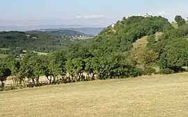 The Chapel of Glavenas, on the hill to the right | |
Location of Saint-Julien-du-Pinet | |
 Saint-Julien-du-Pinet 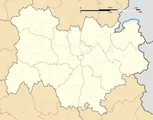 Saint-Julien-du-Pinet | |
| Coordinates: 45°09′10″N 4°02′24″E / 45.1528°N 4.04°E | |
| Country | France |
| Region | Auvergne-Rhône-Alpes |
| Department | Haute-Loire |
| Arrondissement | Yssingeaux |
| Canton | Yssingeaux |
| Intercommunality | CC des Sucs |
| Government | |
| • Mayor (2021–2026) | Christian Gibert[1] |
| Area 1 | 17.2 km2 (6.6 sq mi) |
| Population | 492 |
| • Density | 29/km2 (74/sq mi) |
| Time zone | UTC+01:00 (CET) |
| • Summer (DST) | UTC+02:00 (CEST) |
| INSEE/Postal code | 43203 /43200 |
| Elevation | 637–1,186 m (2,090–3,891 ft) |
| 1 French Land Register data, which excludes lakes, ponds, glaciers > 1 km2 (0.386 sq mi or 247 acres) and river estuaries. | |
Saint-Julien-du-Pinet (French pronunciation: [sɛ̃ ʒyljɛ̃ dy pinɛ]; Occitan: Sant Julian lo Pinet) is a commune in the Haute-Loire department in south-central France.[3]
Population
| Year | Pop. | ±% p.a. |
|---|---|---|
| 1968 | 437 | — |
| 1975 | 336 | −3.68% |
| 1982 | 301 | −1.56% |
| 1990 | 301 | +0.00% |
| 1999 | 345 | +1.53% |
| 2009 | 451 | +2.72% |
| 2014 | 459 | +0.35% |
| 2020 | 490 | +1.10% |
| Source: INSEE[4] | ||
See also
References
- ↑ "Répertoire national des élus: les maires". data.gouv.fr, Plateforme ouverte des données publiques françaises (in French). 9 August 2021.
- ↑ "Populations légales 2021". The National Institute of Statistics and Economic Studies. 28 December 2023.
- ↑ INSEE commune file
- ↑ Population en historique depuis 1968, INSEE
Wikimedia Commons has media related to Saint-Julien-du-Pinet.
This article is issued from Wikipedia. The text is licensed under Creative Commons - Attribution - Sharealike. Additional terms may apply for the media files.