West-Cappel
Westkappel | |
|---|---|
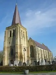 The church in West-Cappel | |
.svg.png.webp) Coat of arms | |
Location of West-Cappel | |
 West-Cappel 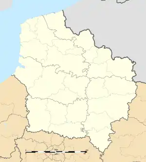 West-Cappel | |
| Coordinates: 50°55′47″N 2°30′22″E / 50.9297°N 2.5061°E | |
| Country | France |
| Region | Hauts-de-France |
| Department | Nord |
| Arrondissement | Dunkerque |
| Canton | Wormhout |
| Intercommunality | Hauts de Flandre |
| Government | |
| • Mayor (2020–2026) | André Figoureux[1] |
| Area 1 | 7.57 km2 (2.92 sq mi) |
| Population | 636 |
| • Density | 84/km2 (220/sq mi) |
| Demonym | West-Cappelois (es) |
| Time zone | UTC+01:00 (CET) |
| • Summer (DST) | UTC+02:00 (CEST) |
| INSEE/Postal code | 59657 /59380 |
| Elevation | 6–27 m (20–89 ft) (avg. 22 m or 72 ft) |
| 1 French Land Register data, which excludes lakes, ponds, glaciers > 1 km2 (0.386 sq mi or 247 acres) and river estuaries. | |
West-Cappel (French pronunciation: [wɛst kapɛl]; Dutch: Westkappel) is a commune in the Nord department in northern France.[3]
Heraldry
Arms of West-Cappel |
The arms of West-Cappel are blazoned : Argent, a bend fusil gules. (probably not heraldically significantly different from Noordpeene)
|
Population
| Year | Pop. | ±% p.a. |
|---|---|---|
| 1968 | 453 | — |
| 1975 | 453 | +0.00% |
| 1982 | 433 | −0.64% |
| 1990 | 497 | +1.74% |
| 1999 | 526 | +0.63% |
| 2007 | 572 | +1.05% |
| 2012 | 570 | −0.07% |
| 2017 | 628 | +1.96% |
| Source: INSEE[4] | ||
See also
References
- ↑ "Répertoire national des élus: les maires". data.gouv.fr, Plateforme ouverte des données publiques françaises (in French). 2 December 2020.
- ↑ "Populations légales 2021". The National Institute of Statistics and Economic Studies. 28 December 2023.
- ↑ INSEE commune file
- ↑ Population en historique depuis 1968, INSEE
Wikimedia Commons has media related to West-Cappel.
This article is issued from Wikipedia. The text is licensed under Creative Commons - Attribution - Sharealike. Additional terms may apply for the media files.