Willard-Hay | |
|---|---|
 | |
| Nickname: Willard-Homewood | |
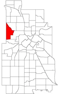 Location of Willard-Hay within the U.S. city of Minneapolis | |
| Country | United States |
| State | Minnesota |
| County | Hennepin |
| City | Minneapolis |
| Community | Near North |
| Area | |
| • Total | 1.068 sq mi (2.77 km2) |
| Population (2020)[2] | |
| • Total | 8,942 |
| • Density | 8,400/sq mi (3,200/km2) |
| Time zone | UTC-6 (CST) |
| • Summer (DST) | UTC-5 (CDT) |
| ZIP code | 55411 |
| Area code | 612 |
Willard-Hay is a neighborhood within the larger Near North community in the northwest side of the U.S. city of Minneapolis which is known locally as the "Northside". The boundaries are roughly Olson Memorial Highway on the south, Penn Avenue on the east, (though a small portion of the neighborhood is northeast of Penn and Plymouth) Broadway Avenue on the northeast and Theodore Wirth Park on the west. The neighborhood is often known as Willard-Homewood by residents; the portion south of Plymouth is Homewood. The neighborhood is named after two elementary schools within its boundaries, Frances Willard and John Hay.44°59′47″N 93°18′40″W / 44.9964°N 93.3112°W[3]
Demographics
| Census | Pop. | Note | %± |
|---|---|---|---|
| 1980 | 8,678 | — | |
| 1990 | 8,409 | −3.1% | |
| 2000 | 9,277 | 10.3% | |
| 2010 | 8,611 | −7.2% | |
| 2020 | 8,942 | 3.8% |
References
- ↑ "Willard-Hay neighborhood in Minneapolis, Minnesota (MN), 55411 detailed profile". City-Data. 2011. Retrieved 2013-11-17.
- ↑ "Willard-Hay neighborhood data". Minnesota Compass. Retrieved 2023-02-19.
- ↑ Willard-Hay, Minneapolis, MN. Google Earth. Retrieved 2011-03-09.
- Willard-Hay, Minneapolis, MN. Google Earth. Retrieved 2011-03-09.
External links
Places adjacent to Willard-Hay, Minneapolis | ||||||||||||||||
|---|---|---|---|---|---|---|---|---|---|---|---|---|---|---|---|---|
| ||||||||||||||||
This article is issued from Wikipedia. The text is licensed under Creative Commons - Attribution - Sharealike. Additional terms may apply for the media files.