Cherré-Au | |
|---|---|
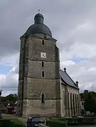 The church of Saint Pierre and Saint Paul in Cherré | |
Location of Cherré-Au | |
 Cherré-Au 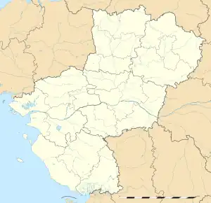 Cherré-Au | |
| Coordinates: 48°10′20″N 0°39′25″E / 48.1722°N 0.6569°E | |
| Country | France |
| Region | Pays de la Loire |
| Department | Sarthe |
| Arrondissement | Mamers |
| Canton | La Ferté-Bernard |
| Intercommunality | CC Pays de l'Huisne Sarthoise |
| Government | |
| • Mayor (2020–2026) | Jannick Niel[1] |
| Area 1 | 30.37 km2 (11.73 sq mi) |
| Population | 2,735 |
| • Density | 90/km2 (230/sq mi) |
| Time zone | UTC+01:00 (CET) |
| • Summer (DST) | UTC+02:00 (CEST) |
| INSEE/Postal code | 72080 /72400 |
| Elevation | 78–189 m (256–620 ft) |
| 1 French Land Register data, which excludes lakes, ponds, glaciers > 1 km2 (0.386 sq mi or 247 acres) and river estuaries. | |
Cherré-Au (French pronunciation: [ʃɛʁe o]) is a commune in the Sarthe department in the Pays de la Loire region in north-western France. It was established on 1 January 2019 by merger of the former communes of Cherré (the seat) and Cherreau.[3]
Population
| Year | Pop. | ±% p.a. |
|---|---|---|
| 1968 | 936 | — |
| 1975 | 1,080 | +2.07% |
| 1982 | 1,633 | +6.08% |
| 1990 | 1,914 | +2.00% |
| 1999 | 2,011 | +0.55% |
| 2007 | 2,425 | +2.37% |
| 2012 | 2,634 | +1.67% |
| 2017 | 2,698 | +0.48% |
| Source: INSEE[4] | ||
See also
References
- ↑ "Répertoire national des élus: les maires" (in French). data.gouv.fr, Plateforme ouverte des données publiques françaises. 13 September 2022.
- ↑ "Populations légales 2021". The National Institute of Statistics and Economic Studies. 28 December 2023.
- ↑ Arrêté préfectoral 13 September 2018 (in French)
- ↑ Population en historique depuis 1968, INSEE
Wikimedia Commons has media related to Cherré-Au.
This article is issued from Wikipedia. The text is licensed under Creative Commons - Attribution - Sharealike. Additional terms may apply for the media files.