Rouperroux-le-Coquet | |
|---|---|
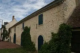 An old barn in the centre of the village | |
Location of Rouperroux-le-Coquet | |
 Rouperroux-le-Coquet 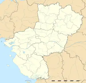 Rouperroux-le-Coquet | |
| Coordinates: 48°13′38″N 0°25′53″E / 48.2272°N 0.4314°E | |
| Country | France |
| Region | Pays de la Loire |
| Department | Sarthe |
| Arrondissement | Mamers |
| Canton | Bonnétable |
| Intercommunality | Maine Saosnois |
| Government | |
| • Mayor (2020–2026) | Pascal Champclou[1] |
| Area 1 | 10.27 km2 (3.97 sq mi) |
| Population | 275 |
| • Density | 27/km2 (69/sq mi) |
| Demonym(s) | Coqueroupéen, Coqueroupéenne |
| Time zone | UTC+01:00 (CET) |
| • Summer (DST) | UTC+02:00 (CEST) |
| INSEE/Postal code | 72259 /72110 |
| Elevation | 72–133 m (236–436 ft) |
| 1 French Land Register data, which excludes lakes, ponds, glaciers > 1 km2 (0.386 sq mi or 247 acres) and river estuaries. | |
Rouperroux-le-Coquet (French pronunciation: [ʁupɛʁu lə kɔkɛ]) is a commune in the Sarthe department in the Pays de la Loire region in north-western France.
See also
References
- ↑ "Répertoire national des élus: les maires". data.gouv.fr, Plateforme ouverte des données publiques françaises (in French). 2 December 2020.
- ↑ "Populations légales 2021". The National Institute of Statistics and Economic Studies. 28 December 2023.
Wikimedia Commons has media related to Rouperroux-le-Coquet.
This article is issued from Wikipedia. The text is licensed under Creative Commons - Attribution - Sharealike. Additional terms may apply for the media files.