Kunice | |
|---|---|
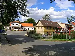 Centre of Kunice | |
 Flag  Coat of arms | |
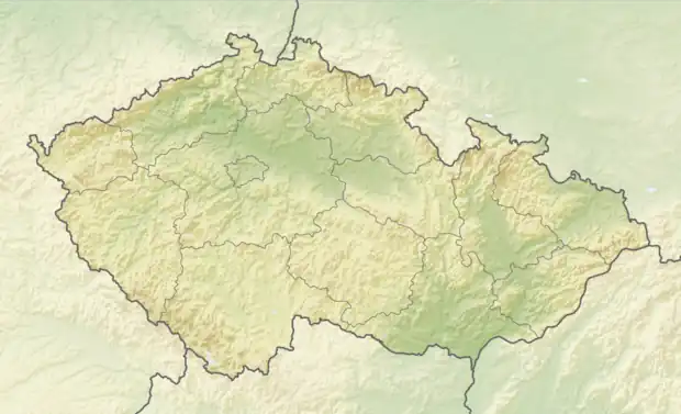 Kunice Location in the Czech Republic | |
| Coordinates: 49°56′12″N 14°40′18″E / 49.93667°N 14.67167°E | |
| Country | |
| Region | Central Bohemian |
| District | Prague-East |
| First mentioned | 970 |
| Area | |
| • Total | 10.41 km2 (4.02 sq mi) |
| Elevation | 419 m (1,375 ft) |
| Population (2023-01-01)[1] | |
| • Total | 1,842 |
| • Density | 180/km2 (460/sq mi) |
| Time zone | UTC+1 (CET) |
| • Summer (DST) | UTC+2 (CEST) |
| Postal code | 251 63 |
| Website | www |
Kunice is a municipality and village in Prague-East District in the Central Bohemian Region of the Czech Republic. It has about 1,800 inhabitants.
Administrative parts
Villages of Dolní Lomnice, Horní Lomnice, Vidovice and Všešímy are administrative parts of Kunice.
Geography
Kunice is located about 15 km (9 mi) southeast of Prague. It lies in the Benešov Uplands. The highest point is at 472 m (1,549 ft) above sea level.
History
The first written mention of Kunice is from 970, when the local church was founded.[2][3]
Transport
The D1 motorway passes through the municipality.
Sport
Football club FK Kunice represents the municipality.
Sights
The landmark of Kunice is the Church of Saint Mary Magdalene. It was built in the Gothic style in the 14th century and rebuilt in the Baroque style in the 17th and 18th centuries.[4]
Berchtold Castle is located in Vidovice. It was built in 1877. Today it serves as a hotel. The ground floor of the castle is open to the public and houses the municipal museum.[5]
References
- ↑ "Population of Municipalities – 1 January 2023". Czech Statistical Office. 2023-05-23.
- ↑ "Kunice (Praha-východ, Česko)" (in Czech). Středočeská vědecká knihovna v Kladně. Retrieved 2023-03-10.
- ↑ "Kostel" (in Czech). Obec Kunice. Retrieved 2023-03-10.
- ↑ "Kostel sv. Maří Magdalény" (in Czech). National Heritage Institute. Retrieved 2023-03-10.
- ↑ "Historie" (in Czech). Hotel Zámek Berchtold. Retrieved 2023-03-10.