Mochov | |
|---|---|
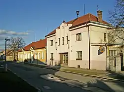 Sokol hall and municipal office | |
 Coat of arms | |
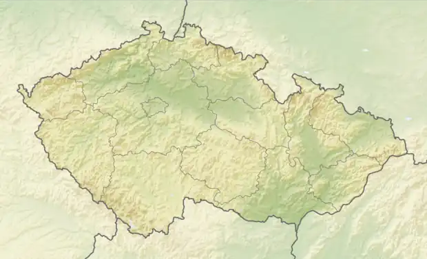 Mochov Location in the Czech Republic | |
| Coordinates: 50°8′31″N 14°47′42″E / 50.14194°N 14.79500°E | |
| Country | |
| Region | Central Bohemian |
| District | Prague-East |
| First mentioned | 1360 |
| Area | |
| • Total | 9.32 km2 (3.60 sq mi) |
| Elevation | 193 m (633 ft) |
| Population (2023-01-01)[1] | |
| • Total | 1,646 |
| • Density | 180/km2 (460/sq mi) |
| Time zone | UTC+1 (CET) |
| • Summer (DST) | UTC+2 (CEST) |
| Postal code | 250 87 |
| Website | www |
Mochov is a municipality and village in Prague-East District in the Central Bohemian Region of the Czech Republic. It has about 1,600 inhabitants.
Geography
Mochov is located about 18 km (11 mi) east of Prague. It lies in a flat agricultural landscape in the Central Elbe Table. The Výmola Brook flows through the municipality.
History
The first written mention of Mochov is from 1360. From 1437 to 1611, the village belonged to the Přerov estate. Then Emperor Rudolf II sold Mochov to Magdalena Trčka of Lípa, who joined it to the Kounice estate. It remained part of this estate until the establishment of an independent municipality in 1850.[2]
Transport
The D11 motorway (part of the European route E67) from Prague to Hradec Králové passes through the municipality.
Sights
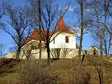
The landmark of Mochov is the Church of Saint Bartholomew. It is originally a late Gothic church from the 13th century, which was later baroque rebuilt.[3]
References
- ↑ "Population of Municipalities – 1 January 2023". Czech Statistical Office. 2023-05-23.
- ↑ "Historie obce" (in Czech). Obec Mochov. Retrieved 2021-06-19.
- ↑ "Kostel sv. Bartoloměje" (in Czech). National Heritage Institute. Retrieved 2023-03-04.