La Chapelle-Saint-Laurian | |
|---|---|
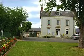 Town hall | |
Location of La Chapelle-Saint-Laurian | |
 La Chapelle-Saint-Laurian 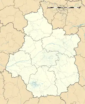 La Chapelle-Saint-Laurian | |
| Coordinates: 47°03′47″N 1°47′02″E / 47.0631°N 1.7839°E | |
| Country | France |
| Region | Centre-Val de Loire |
| Department | Indre |
| Arrondissement | Issoudun |
| Canton | Levroux |
| Government | |
| • Mayor (2020–2026) | Sylvain Auger[1] |
| Area 1 | 9.82 km2 (3.79 sq mi) |
| Population | 135 |
| • Density | 14/km2 (36/sq mi) |
| Time zone | UTC+01:00 (CET) |
| • Summer (DST) | UTC+02:00 (CEST) |
| INSEE/Postal code | 36041 /36150 |
| Elevation | 125–174 m (410–571 ft) (avg. 200 m or 660 ft) |
| 1 French Land Register data, which excludes lakes, ponds, glaciers > 1 km2 (0.386 sq mi or 247 acres) and river estuaries. | |
La Chapelle-Saint-Laurian (French pronunciation: [la ʃapɛl sɛ̃ loʁjɑ̃]) is a commune in the Indre department in central France.
Population
| Year | Pop. | ±% p.a. |
|---|---|---|
| 1968 | 162 | — |
| 1975 | 140 | −2.06% |
| 1982 | 162 | +2.11% |
| 1990 | 135 | −2.25% |
| 1999 | 141 | +0.48% |
| 2009 | 137 | −0.29% |
| 2014 | 142 | +0.72% |
| 2020 | 136 | −0.72% |
| Source: INSEE[3] | ||
See also
References
- ↑ "Répertoire national des élus: les maires". data.gouv.fr, Plateforme ouverte des données publiques françaises (in French). 9 August 2021.
- ↑ "Populations légales 2021". The National Institute of Statistics and Economic Studies. 28 December 2023.
- ↑ Population en historique depuis 1968, INSEE
Wikimedia Commons has media related to La Chapelle-Saint-Laurian.
This article is issued from Wikipedia. The text is licensed under Creative Commons - Attribution - Sharealike. Additional terms may apply for the media files.