Saint-Aubin-le-Monial | |
|---|---|
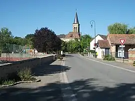 View of Saint-Aubin-le-Monial from Rue des Écoles, and the Saint-Barnabé church in the second ground. | |
 Coat of arms | |
Location of Saint-Aubin-le-Monial | |
 Saint-Aubin-le-Monial 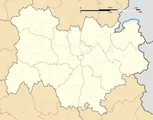 Saint-Aubin-le-Monial | |
| Coordinates: 46°31′43″N 2°59′55″E / 46.5286°N 2.9986°E | |
| Country | France |
| Region | Auvergne-Rhône-Alpes |
| Department | Allier |
| Arrondissement | Moulins |
| Canton | Bourbon-l'Archambault |
| Intercommunality | Bocage Bourbonnais |
| Government | |
| • Mayor (2020–2026) | Françoise Guilleminot[1] |
| Area 1 | 21.63 km2 (8.35 sq mi) |
| Population | 268 |
| • Density | 12/km2 (32/sq mi) |
| Time zone | UTC+01:00 (CET) |
| • Summer (DST) | UTC+02:00 (CEST) |
| INSEE/Postal code | 03218 /03160 |
| Elevation | 247–331 m (810–1,086 ft) (avg. 300 m or 980 ft) |
| 1 French Land Register data, which excludes lakes, ponds, glaciers > 1 km2 (0.386 sq mi or 247 acres) and river estuaries. | |
Saint-Aubin-le-Monial (French pronunciation: [sɛ̃.t‿obɛ̃ lə mɔnjal]) is a commune in the Allier department in Auvergne-Rhône-Alpes in central France.
Population
| Year | Pop. | ±% |
|---|---|---|
| 1962 | 343 | — |
| 1968 | 403 | +17.5% |
| 1975 | 295 | −26.8% |
| 1982 | 273 | −7.5% |
| 1990 | 269 | −1.5% |
| 1999 | 278 | +3.3% |
| 2008 | 289 | +4.0% |
| 2013 | 275 | −4.8% |
| Source: INSEE (1968–2013) | ||
See also
References
- ↑ "Répertoire national des élus: les maires". data.gouv.fr, Plateforme ouverte des données publiques françaises (in French). 2 December 2020.
- ↑ "Populations légales 2021". The National Institute of Statistics and Economic Studies. 28 December 2023.
Wikimedia Commons has media related to Saint-Aubin-le-Monial.
This article is issued from Wikipedia. The text is licensed under Creative Commons - Attribution - Sharealike. Additional terms may apply for the media files.